
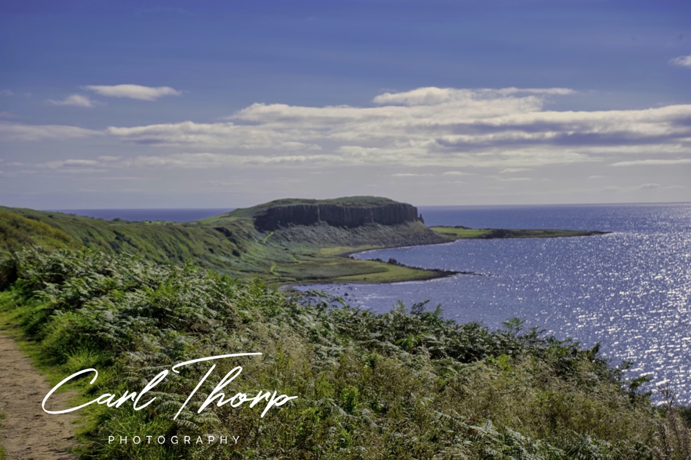
Another beautiful day on Arran so we decided to go and find Kings Caves located between Blackwaterfoot and Tormore on the west coast of Arran. #isleofarran #scotland #adventure
This is one of several Scottish caves that lay claim to being the one where Robert the Bruce watched a spider try and try again to build its web on the wall of the cave.
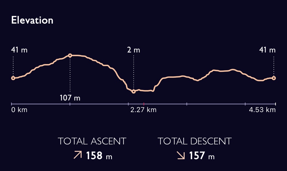
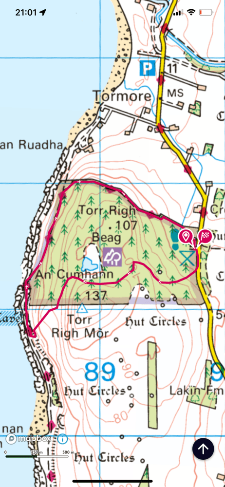
Setting off from the car park we nearly took the obvious exit and path. A quick look at the map showed it’s better to walk the route clockwise rather than anti-clockwise as this makes the steepest parts of the route downhill rather than uphill.
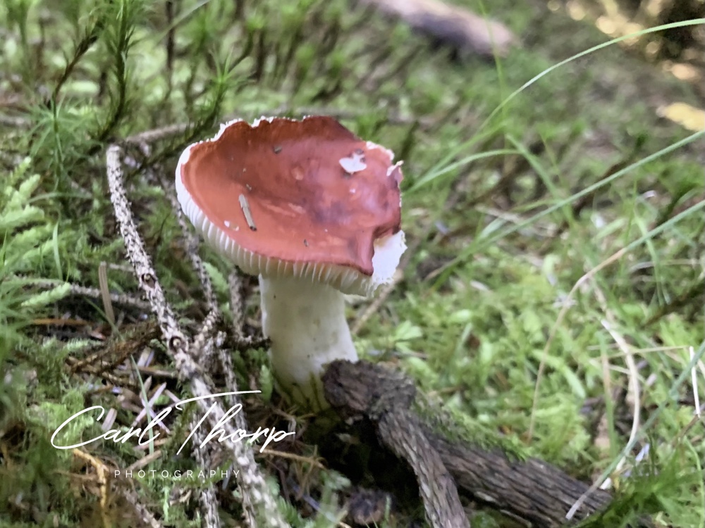
Heading through the at what we first thought was a typical mono-culture pine forest being grown for logging. But we soon came a cross lots of different fungi growing in the shade of the trees.
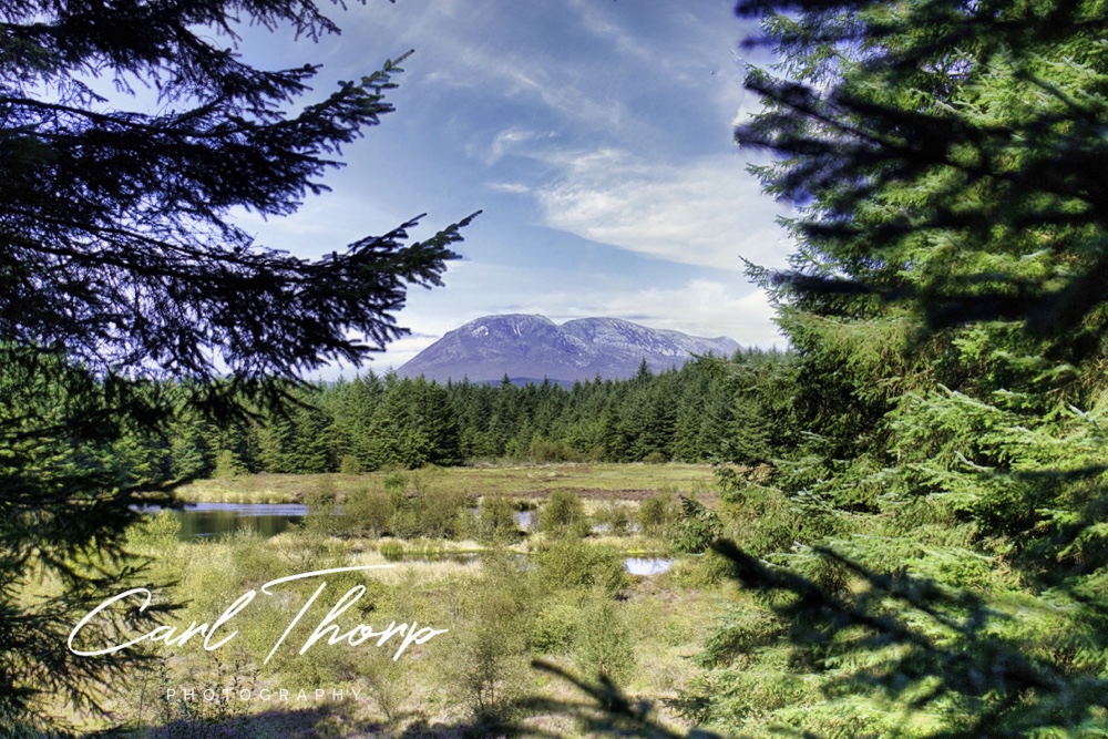
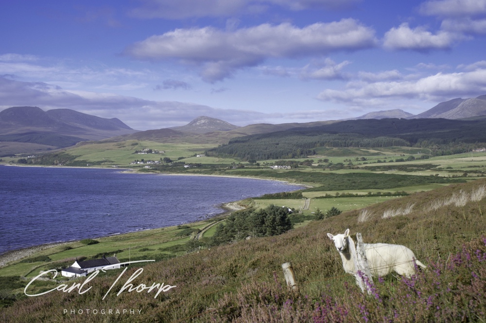
As we approached the top of the path the trees opened up to show a view of a small loch and the mountains beyond.
As we headed down hill the gap in the trees widened and the air was soon swarming with dragon flies. I wish I had been able to get photos of them. It was like being in another world.
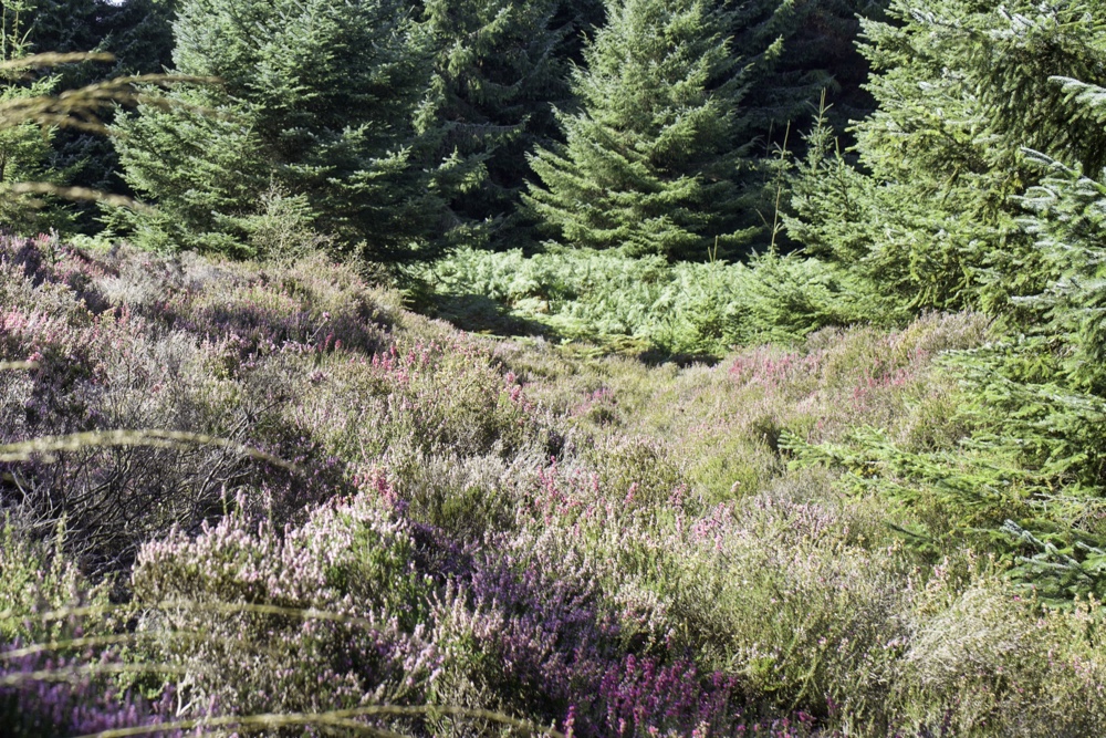
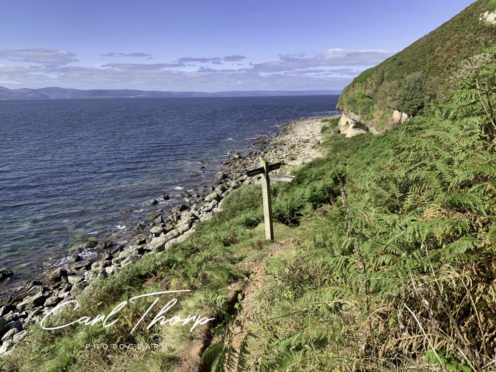
Eventually you pass through a steel gate and out onto a moorland of bracken. Watch your footing as the path narrows and drops rapidly as it zig zags down to the see.
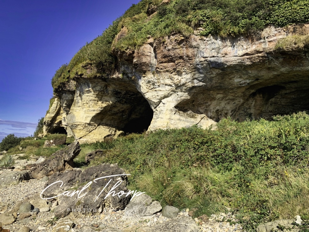
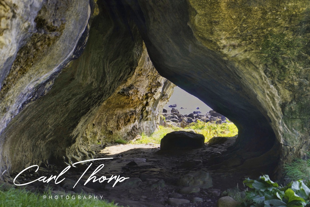
Passing a sign post for the caves you can see them in the sand stone cliffs.
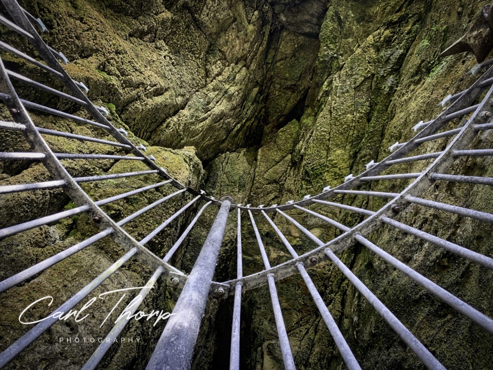
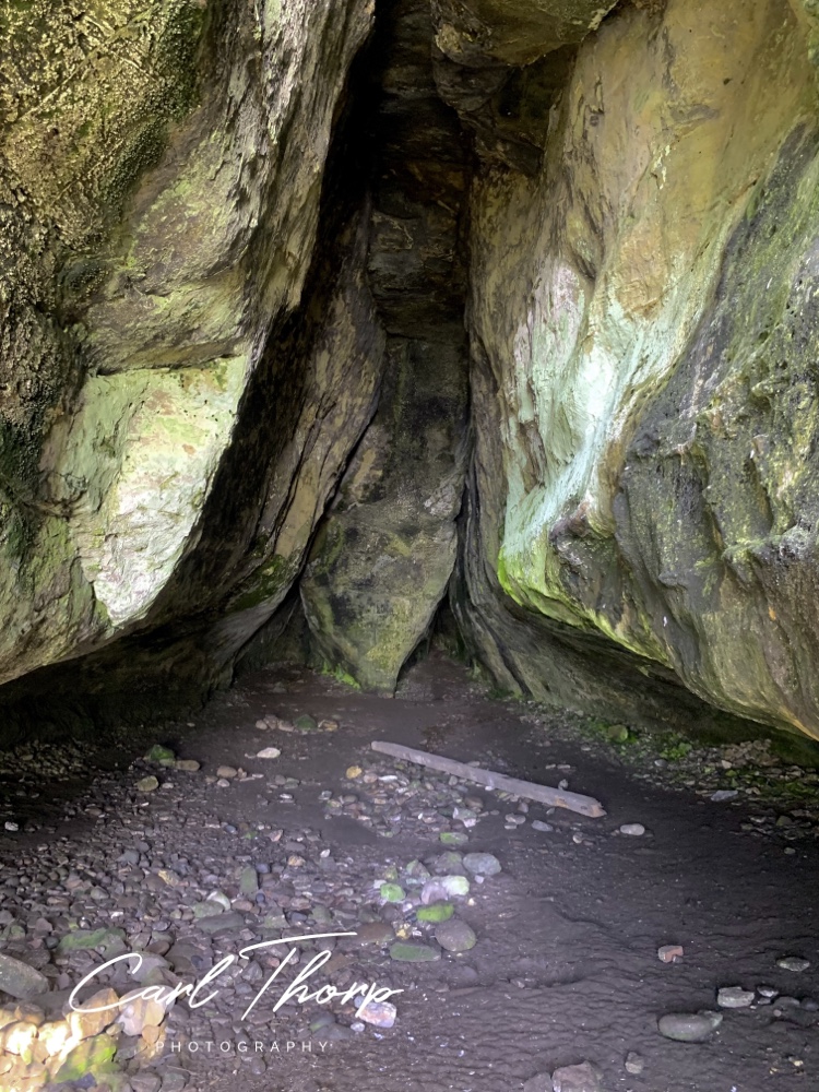
The main cave has an metal grill over it although we found the gate was not locked and entered the cave. It was interesting to try and find all the markings and pictures that had been made on the cave walls.
To return to the car park we set off following the rest of the path. Its a steady ascent but not like what we would have faced had we walked in the same direction everyone else was walking.
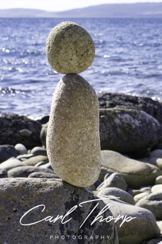
Returning to the beach we sat by the odd looking rock sculptures people had left on the beach and had a drink and some food. Then just sat there listening to the sea and the birds. Pure heaven.
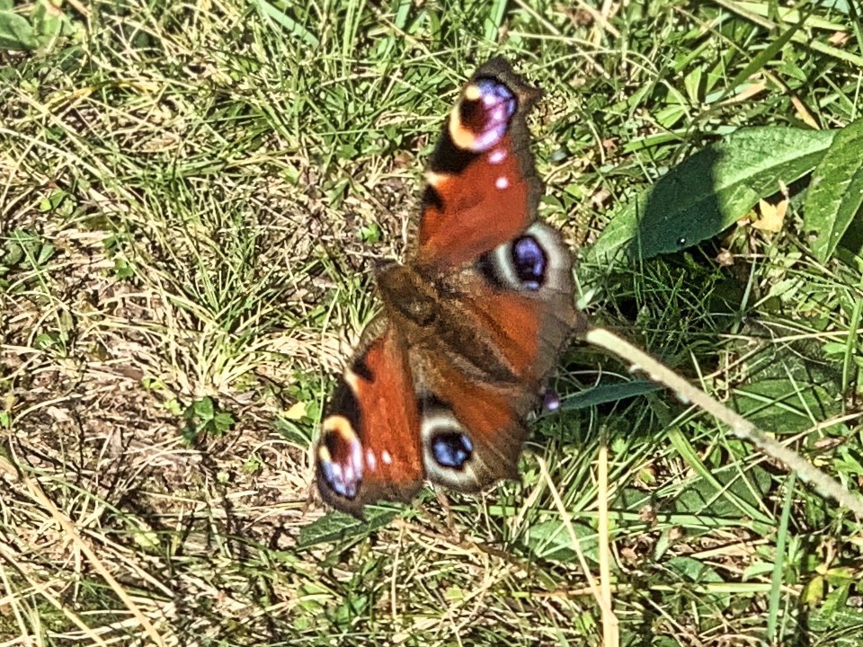
Along the way we spotted a beautiful European Peacock butterfly and it took several attempts to get a photo of it as every time I line my camera up if flew off up the path.
As we ascended the views opened up and became breathtaking over Machrie Bay and the mountains beyond.
Eventually the path loops back through the forest and to the car park. Another wonderful afternoon walk through the September sunshine.

We have taken all reasonable steps to ensure these walks are safe and correctly described. However, there may be changes in the area or to maps that we are not aware off. All outdoor activities come with a degree of risk and you should ensure you are adequately prepared before undertaking them. This route, maps and GPX traces are to be used as a guide only, it’s accuracy may change with the scale of map you are using or type of GPS device. Always use in conjunction with a paper map and ensure you now how to read it. We take no responsibility for any errors, omissions, injuries or accidents whilst following this walk.

