
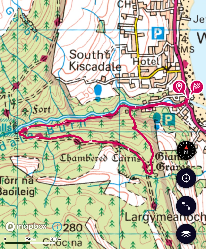
After parking by the sea we headed up Glenashdale. The walk meanders alongside the river, through the cool of the forest before a steeper climb up to the waterfall. #isleofarran #scotland #adventure
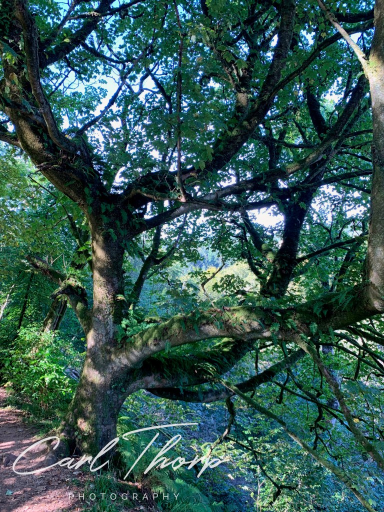
One of the things the local woodland is noted for is its ferns. They even grown up in the trees. In victorian days collectors used to visit this remnant of the ancient Atlantic Rainforest.
As the path gains height the views over Whiting Bay gradually open up.
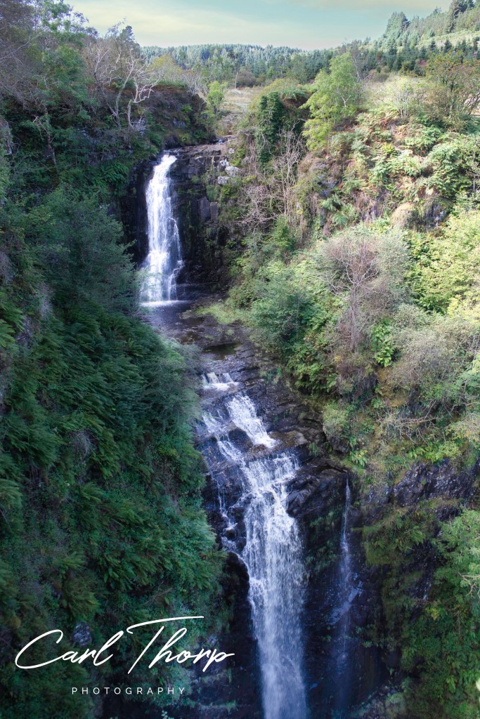
After a final climb up the well laid path we arrived at the viewing platform over the Glenasdale falls or in Gaelic Eas a’ Chrannaig. It’s an impressive double fall.
Having lingered over the falls we set off to find the Giants Graves. The forest track took a little longer than we expected but the views that opened up over Whiting Bay, Holy Island and across to the Mountains were wonderful.
We met a people walking the opposite direction and stopped for a chat. They all said the same thing that the walk between the Graves and the falls was longer than expected.
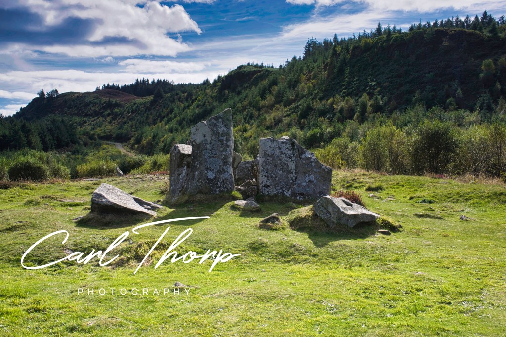
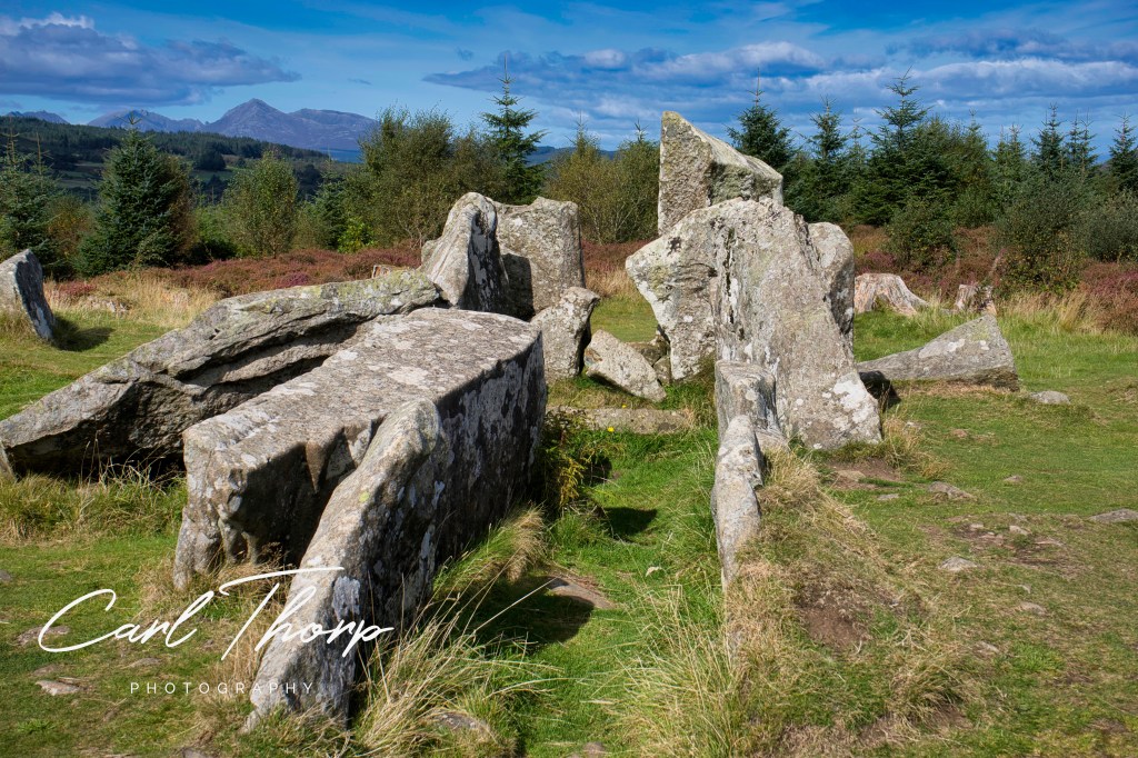
Arriving at the graves it’s easy to see why people thought they were the graves of long dead giants. It’s a shame these 5000 year Neolithic burial mounds have been damaged, but they still hold a silent hold a silent beauty and prescience.
Setting off back down the track to Whiting Bay we found the almost hidden visitor sign for the graves.
Part way down we stopped at a picnic table to enjoy the view over the bay and were rewarded with a fly past of an eagle. It’s the first one we had seen since coming to the island and we couldn’t help but just sit there and watch it gliding by.
The path then steeply zig zags back down to join the path we started on. Once again I was glad I had checked the map and not walked the way up that we came down.
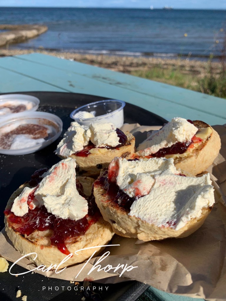
Arriving back at the car the dogs had a paddle in the river to cool off and then we stopped at the The Shore restaurant and enjoyed a treat whilst sitting in the sun and watching the sea bird in the bay.
At then end of the walk we stopped at the Shore restaurant in Whiting Bay for a tasty treat sat by the sea and enjoying the view.
We have taken all reasonable steps to ensure these walks are safe and correctly described. However, there may be changes in the area or to maps that we are not aware off. All outdoor activities come with a degree of risk and you should ensure you are adequately prepared before undertaking them. This route, maps and GPX traces are to be used as a guide only, it’s accuracy may change with the scale of map you are using or type of GPS device. Always use in conjunction with a paper map and ensure you now how to read it. We take no responsibility for any errors, omissions, injuries or accidents whilst following this walk.

